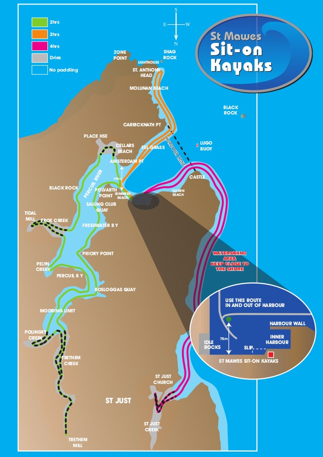
Some have asked why I produced this chart essentially upside down! That is, with South up instead of North.
The answer is very simple-
When we are stood on the slipway, explaining routes to paddlers, gazing wistfully out to sea we are facing (as near as damn it) South. So I produced the chart this way around so everything is the right way up, and it is easier to explain to someone who may not be familiar with nautical charts.
As paddlers don’t normally need to take compass bearings I think it’s ok…


